Blog
Keep updated with recent real estate news.
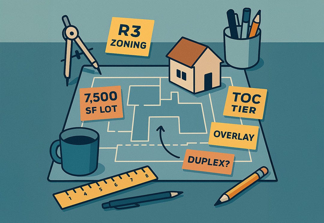
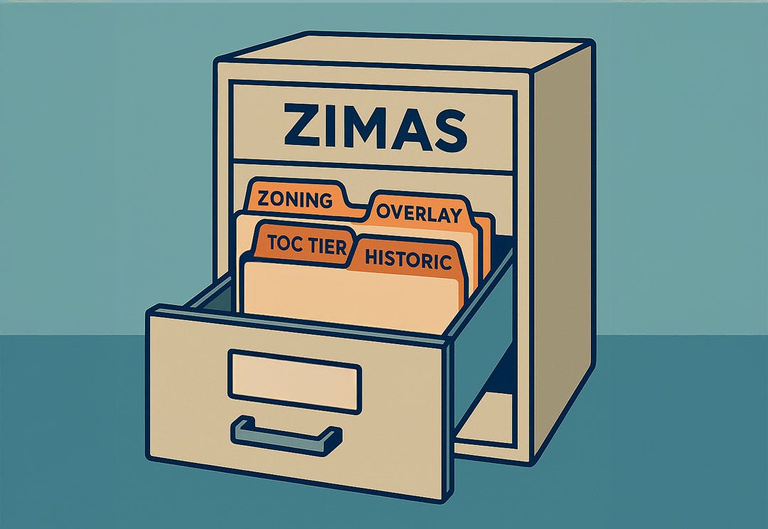
How to Read a ZIMAS Report Without a Planning Degree

Most visitors bail out of ZIMAS within thirty seconds. The screen is crowded with Q Conditions, liquefaction zones, and a dozen other planner terms that can feel like a foreign language. Yet ZIMAS, the City of Los Angeles Zone Information and Map Access System, is the very database city staff consult before they approve or deny permits. In other words, if you care about what can be built on a lot, you might want to continue reading. (planning.lacity.org)
The good news is that you do not need a planning degree to unlock the essentials. By focusing on just five things you can see how many units the zoning allows, which overlays might increase density, and whether environmental flags like methane or slope could add cost. This guide walks through those tabs step by step so you can read a ZIMAS parcel report with confidence and decide before hiring an architect whether a property deserves deeper due diligence.
What You’ll Learn From a ZIMAS Report
ZIMAS picks up where listing sites leave off, replacing neighborhood snapshots with the hard rules that shape every building project in Los Angeles. Open a parcel and the report reveals the base zoning code that sets height and density, the recorded lot size that drives setbacks, and the overlay layers. Transit Oriented Communities tiers, Specific Plans, historic districts, and environmental hazard zones that can either unlock bonuses or trigger extra requirements. In a few clicks, you can see whether an ADU fits in the backyard, if a duplex is possible under SB 9, and what environmental studies might be required long before you pay for surveys or architectural drawings.
Bottom line: A five-minute scan of these fields tells you what you can build, how big, and which red flags could drive up costs long before you order a survey or hire a drafter. Zillow cannot give you any of that.
The five ZIMAS tabs you actually need
ZIMAS offers more information than most people will ever use. If you focus on the five tabs below, you can answer ninety percent of the questions that come up in early site planning.
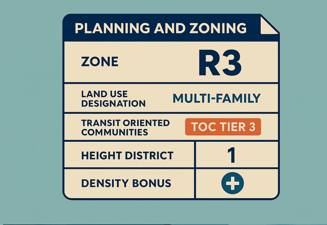
Planning and Zoning tab
Start here. The Zone field shows the base designation such as R1 or RD2, while Land Use Designation confirms if the parcel is intended for single-family, multi-family, or mixed use. This tab also lists Transit Oriented Communities tiers, height districts, and any special density bonuses that apply. All data is fed directly from the city’s zoning database, which is why planning staff ask applicants to attach this screen to formal filings. (planning.lacity)
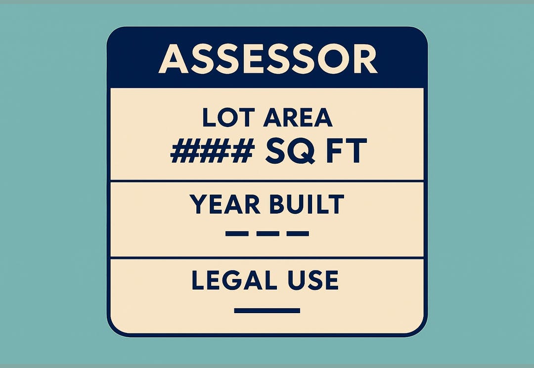
Assessor tab
This is where you find the recorded lot area, the year the main structure was built, and the “Legal Use” description on file with the County Assessor. Lot area matters because Los Angeles calculates setbacks and some density limits from the deeded square footage, not the tape-measure size on the ground. (Planning.lacity)
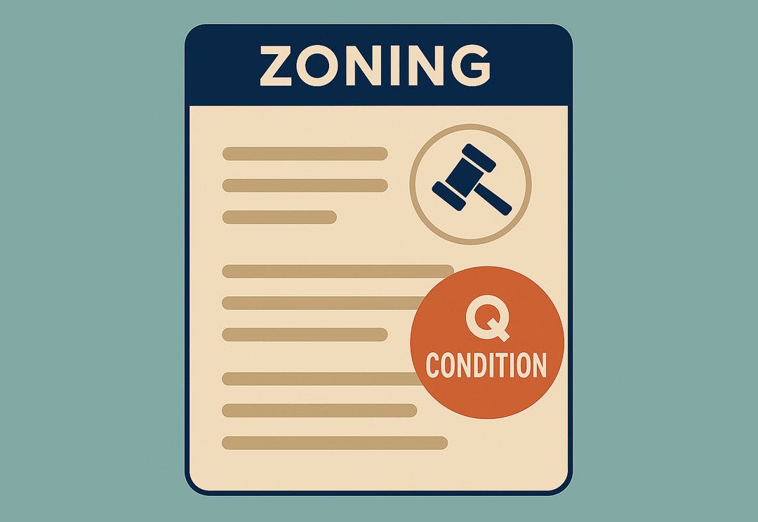
Zoning tab
If the Planning and Zoning tab gives you the rulebook, the Zoning tab tells you about any extra fine print. Look for Q Conditions or D Limitations, which can cap floor-area ratio, require additional parking, or restrict certain uses even when the base zone would normally allow them. ZIMAS links each condition to the City Council ordinance that created it, so you can read the source document in one click. (Planning.lacity)
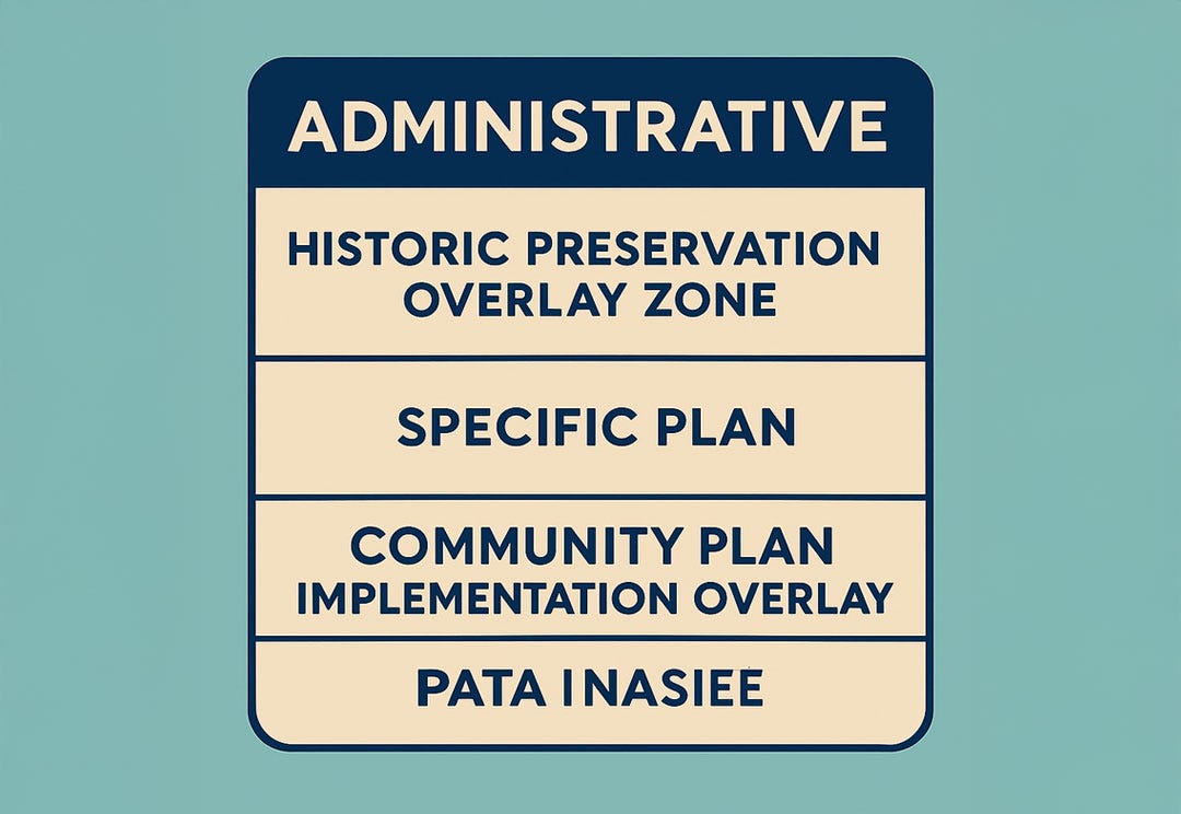
Administrative tab
Historic Preservation Overlay Zones, Specific Plans, Community Plan Implementation Overlays, and Redevelopment Areas all live here. If any of these fields show something other than “None,” expect design review or special procedures before permits are issued. The city’s historic preservation guide recommends using this tab to confirm whether a parcel is inside an HPOZ boundary. (Planning.lacity)
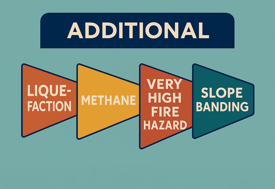
Additional tab
Finally, scan the environmental flags such as Liquefaction, Methane, Very High Fire Hazard, and Slope Banding. A liquefaction flag means you will need a soils report before the Department of Building and Safety will clear your plans. (ladbs.org)
Pro tip: When time is short, read just two fields in the Planning and Zoning tab: Zone and Land Use Designation. They tell you, in a single line each, what the city already allows on the lot and where the major limits begin.
Quick Zoning Wins and Warnings
Not every parcel worth a second look will be perfect, but there are quick signs that tell you whether to lean in or walk away.
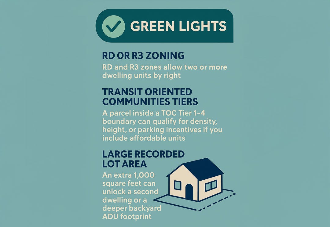
Green lights
- RD or R3 zoning. RD and R3 zones allow two or more dwelling units by right, which makes adding an ADU or pursuing a small?lot subdivision far simpler than in single-family R1 zones. (planning.lacity)
- Transit Oriented Communities tiers. A parcel inside a TOC Tier 1–4 boundary can qualify for density, height, or parking incentives if you include affordable units. The program was created by Measure JJJ and is spelled out in the city’s TOC guidelines. (planning.lacity)
- Large recorded lot area. Because L.A. ties setbacks and unit counts to the legal lot size on the Assessor roll, an extra 1,000 square feet can unlock a second dwelling or a deeper backyard ADU footprint.
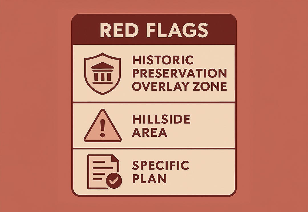
Red flags
- Historic Preservation Overlay Zone. Every exterior change inside an HPOZ requires staff or board review and must follow a district Preservation Plan, which can add time and design constraints. (planning.lacity)
- Hillside area or Baseline Hillside Ordinance overlay. Parcels flagged as Hillside face strict grading limits, additional structural requirements, and longer plan checks under Los Angeles Municipal Code Section 91.7006.7.4. (ladbs.org)
- Specific Plans with special conditions. Specific Plans act as mini-zoning codes. They can cap floor-area ratio, mandate architectural styles, or require discretionary review, all of which add cost and uncertainty. (planning.lacity)
Spotting these signals in ZIMAS helps you sort opportunities from time sinks before you spend on surveys or concept drawings.
From map to details: how Terrakan and ZIMAS work together
A. ZIMAS is the source of truth
The Zone Information and Map Access System pulls its records straight from the Department of City Planning’s databases, so every zone, overlay, and parcel history you see in the tool mirrors what staff use when they review permits. That includes the legal zoning designation, land-use category, Transit Oriented Communities tier, and any historic or environmental layer tied to the lot. All serious land-use research in Los Angeles ultimately circles back to ZIMAS because it is the city’s own data feed. (planning.lacity)
B. Why people struggle with it
The interface was built for planners, not weekend house-hunters. Information is spread across multiple tabs, the search bar rejects typos, and terms like “Q Condition” or “Specific Plan” rarely come with plain-English help text. As a result, many users hop in, see a wall of acronyms, and give up.
C. Where Terrakan comes in
Terrakan is designed to surface the same zoning potential at a glance. The platform highlights TOC tiers, ADU feasibility, base zone, and key constraints in everyday language so you can spot promising parcels without opening five different tabs. Once a site looks interesting, you can click through to ZIMAS for the official record.
D. Use both for better decisions
Start with Terrakan when you are browsing or comparing properties. Move to ZIMAS for due diligence when you need to confirm unit counts, overlay conditions, or a hillside flag. The combination lets you work quickly while staying anchored to the city’s authoritative data.

Final Thoughts: Turn the Data into Action
ZIMAS may look like it was built for city planners, yet the moment you know where the five key tabs live, it turns into a practical playbook for every Los Angeles homeowner or investor. Those fields reveal what the zoning code really allows, which overlays tighten or loosen the rules, and whether a lot is a hidden green light or a costly red flag. Pair that ground-truth data with Terrakan’s at-a-glance summaries and you get the best of both worlds: speed for day-to-day searching and official detail for final due diligence.
Next time you open a listing, run the address in Terrakan, spot the potential, then click through to ZIMAS for confirmation. Ten minutes with both tools will give you clearer answers than hours spent on listing sites that ignore the planning code altogether. That workflow keeps your budget, your timeline, and your project goals aligned with the rules the city actually enforces. Want help evaluating a specific parcel? Drop the address into Terrakan and start with a zoning snapshot in seconds.


